Miranda Frison, President
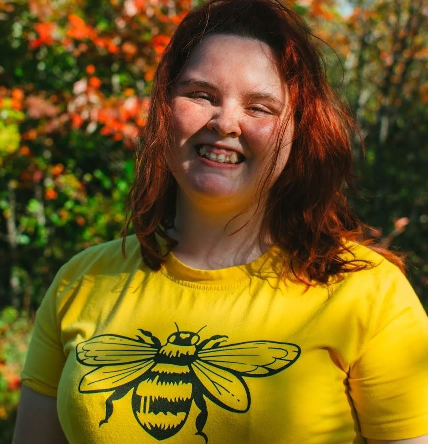 Miranda completed her Geographic Information Systems (GIS) Graduate Certificate from Centre of Geographic Sciences (COGS) in Spring 2022. She has always been naturally curious about the world around her. It is one of the things that drew Miranda towards their studies at Dalhousie University, where they studied Biology, English, and Organic Agriculture. Her passion is to communicate the importance of conservation to the public and found that studying geomatics was a way to achieve this goal. Miranda is currently in graduate school working on a Master of Arts in Geography.
Liam Gowan, Vice-President
 Liam has over six years of experience in the GIS industry, primarily as a developer with MapDev Technology Solutions Inc. since 2019. He has a passion for solving geospatial problems and creating user-friendly applications. At MapDev, he’s worked across web, desktop, and mobile platforms, as well as ArcGIS Pro add-ins, for clients in government, real estate, and utilities.Based in Halifax, Liam holds a Bachelor of Computer Science with a Specialization in Communications Technology & Cyber Security from Dalhousie University (2018) and an Advanced Diploma in Geographic Sciences from COGS (2019).
Ted MacKinnon, Board Director

Ted is a long‑standing contributor to the Canadian geospatial community, recognized for his leadership in promoting geographic information, mapping, geo-literacy, and the advancement of geospatial technologies across Canada.
With more than three decades of experience spanning GIS, cartography, remote sensing, GPS surveying, and geomatics, he has become a trusted voice in the geomatics sector. He graduated from the Centre of Geographic Sciences (COGS) with advanced diplomas in both Remote Sensing and Applied Geomatics Research (Lidar focused) and with a B.Sc. in Geology from Acadia University. He was accredited with a GISP from the GIS Certification Institute (GISCI), a Geomatics Specialist in Remote Sensing certification from the Canadian Institute of Geomatics (CIG), and is a Fellow with the Royal Canadian Geographic Society.
Ted brings to the GANS Board a blend of expertise, experience, and a passion for making geomatics accessible to everyone. His ongoing contributions continue to elevate the visibility of geospatial community within the broader Canadian geospatial landscape.
Dave MacLean, Board Director / Treasurer
Dave has been instructing Advanced GIS at the Centre of Geographic Sciences since 2001. Prior to that, he worked at Industrial Forestry Service Ltd. in Prince George, British Columbia; the Centre of GIS, State of Qatar; and J.D. Irving, Limited (Woodlands Division), in Saint John, New Brunswick.
Dave graduated from Nova Scotia Land Survey Institute (now COGS - NSCC), from TUNS (now Dal), and Acadia. He is a Fellow of the Royal Canadian Geographic Society, has been involved with GANS since 2011, (and is often looking for student projects).
Jeff McKenna, Board Director
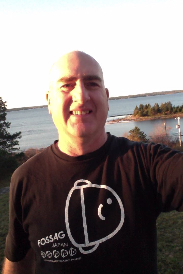 Jeff has been in the spatial field for 28+ years, and has been focusing on sharing geospatial information through the Internet using Open Source since the year 1998. Highly regarded internationally for his promotion of Open Source mapping software and data sharing standards, Jeff is the co-founder of the FOSS4G (Free and Open Source Software for Geospatial) annual global conference, and was the driving force behind moving it around to all areas of the globe, since back in 2004. In 2016 Jeff was the recipient of the prestigious Sol Katz Award, in recognition for leadership in the FOSS4G community worldwide. Jeff is also the President Emeritus of the OSGeo foundation.
Jeff is heavily involved in the MapServer software project, and an active member of the MapServer Project Steering Committee. He also actively contributes to the OGC (Open Geospatial Consortium) and its industry standards for data sharing.
Jeff is the creator and developer of MS4W (MapServer for Windows) which is downloaded and installed 6,000+ times per month, that helps organizations of all sizes to publish and share their geospatial information.
Locally, Jeff operates a consulting company, GatewayGeo, along the beautiful South Shore in Lunenburg, and is a past Vice President of GANS.
Adam Nearing, Board Director
 Adam is new to the geomatics industry, having recently completed the Graduate Certificate Program in GIS from COGS in 2026. Prior to studying at COGS, Adam earned a Diploma in IT Programming from NSCC and, before that, a BFA in Film Studies from NSCAD University. While studying IT Programming, he discovered geomatics and realized it perfectly combined his technical skills with his lifelong interest in landscapes.
As a born-and-raised Cape Bretoner, Adam has always been captivated by the land around him. He finds most of his geomatics interests pointing in the direction of land usage analysis and 3D terrain modelling. His goal is to grow his connection within the geomatics community through continuous involvement and collaboration with like-minded individuals.
Student Director #1: vacant
Student Director #2: vacant
